

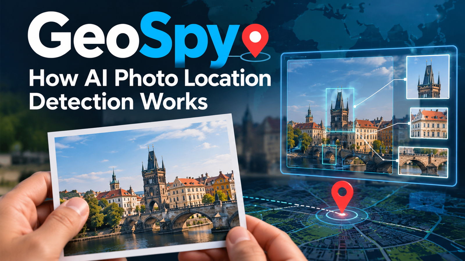
GeoSpy: How AI Can Identify Where a Photo Was Taken

GeoSpy is an AI-powered image geolocation technology designed to estimate where a photograph was taken by analyzing visual information. Instead of relying entirely on GPS coordinates or embedded photo metadata, it can examine details such as buildings, road markings, vegetation, signs, terrain, and surrounding landmarks to identify a possible location.
The technology has attracted attention because it demonstrates how artificial intelligence can extract geographical clues from an ordinary image. A photograph that appears unremarkable to a person may contain enough visual information for an AI system to narrow down its likely location.
However, there is an important distinction between estimating a location and proving where a photograph was taken. Results depend on the image, available visual clues, and the system being used. GeoSpy is also a name associated with different online services, so understanding which product you are using matters. This guide explains how GeoSpy works, its practical applications, accuracy limitations, privacy concerns, and what users should know before uploading photographs.
What Is GeoSpy AI?
GeoSpy is the original name of an AI image geolocation platform developed by Graylark Technologies. In April 2026, the company transitioned the platform to Raven, expanding its focus beyond image location estimation into a broader visual intelligence system for investigative organizations.
The central idea is straightforward: photographs contain geographical clues, even when their GPS metadata has been removed. An AI system can analyze those clues and rank possible locations for further investigation.
It is important to distinguish the original Graylark product from independent websites and mobile applications that also use the GeoSpy name. They may have different operators, capabilities, pricing, and privacy policies.
The original platform is primarily aimed at qualified government, law-enforcement, and investigative organizations rather than being a general-purpose consumer photo app. Its capabilities should therefore be assessed in the context of professional image analysis.
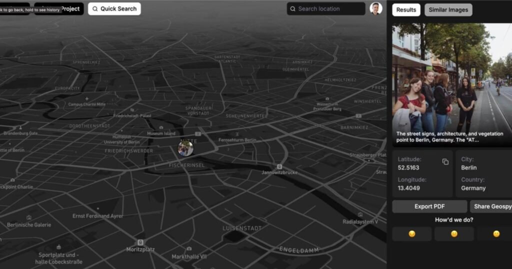
How Does GeoSpy Work?
GeoSpy’s underlying approach is known as image geolocation. It uses visual evidence to estimate the geographical origin of a photograph without requiring embedded GPS coordinates.
1. Analyzing the Visual Content
The system examines features visible in an image, potentially including:
- Architecture: Building materials, roof shapes, window designs, and construction styles.
- Road infrastructure: Road markings, traffic signs, street layouts, and roadside objects.
- Natural surroundings: Vegetation, terrain, coastlines, and landscape features.
- Landmarks: Recognizable buildings, bridges, monuments, and other distinctive structures.
- Environmental context: Combinations of details that may be more common in one region than another.
Individual clues are rarely conclusive. A particular architectural style, for example, may appear in several countries. The value comes from evaluating multiple signals together.
2. Comparing Patterns With Learned Geographical Information
Machine-learning models can learn relationships between visual features and geographical locations from image data associated with known places.
This is a form of computer vision, a field of AI concerned with interpreting images and video. Depending on the system, image representations may be compared with learned geographical patterns or reference imagery.
Graylark’s original GeoSpy technology describes location prediction based on image content, but the exact model architecture and training data should not be assumed to be publicly known in full.
3. Ranking Possible Locations
Rather than treating every prediction as a confirmed answer, a geolocation system can return several candidate locations in order of estimated relevance.
For example, imagine a photograph showing a distinctive street, a particular style of building, and road signs in an unfamiliar language. The system might narrow the possibilities to a particular country or city before identifying candidate streets.
This is a hypothetical example, not a documented GeoSpy test result. The actual precision depends on the photograph, the model, and the geographical coverage available.
4. Human Verification
The final step is to examine the suggested location against independent evidence. An investigator might compare building façades, road layouts, entrances, or other visible features with reference imagery.
This distinction matters: an AI-generated location is a lead to verify, not proof that an image was captured there.
Key Features and Capabilities
GeoSpy’s original image geolocation technology provides the foundation for the location-analysis capabilities now associated with Raven.
| Capability | What It Does |
|---|---|
| Image geolocation | Estimates likely locations from visual information. |
| Regional search | Narrows the likely geographical area of an image. |
| Street-level investigation | Helps identify candidate streets for human review. |
| Property-level analysis | Supports more specific location investigations in supported workflows. |
| Visual evidence review | Helps investigators compare candidate locations with source imagery. |
These capabilities describe Graylark’s current Raven platform and its evolution from GeoSpy. Availability and precision depend on the particular capability, image, supported area, and access permissions.
The important distinction is that broader investigative capabilities should not automatically be attributed to every third-party website or app using the GeoSpy name.
Practical Uses of GeoSpy Technology
Image geolocation can be useful whenever a photograph needs geographical context. The appropriate use depends on the purpose, the image source, and the potential consequences of an incorrect result.
Investigative Research and Public Safety
Authorized investigators may use image geolocation to develop leads from photographs or video frames that lack reliable location information.
For instance, a public photograph containing a distinctive building might help an investigator identify an area to examine more closely. The location would still require corroboration through appropriate evidence and investigative procedures.
Graylark describes Raven as a platform for law-enforcement, government, public-safety, and other qualified investigative teams. Its reported capabilities reflect the company’s own product descriptions, not an independent guarantee of investigative success.
Journalism and Open-Source Research
Journalists and researchers sometimes need to establish where an image originated or whether a claimed location is plausible.
AI-assisted geolocation can suggest places to investigate, but it should be combined with source verification, publication dates, reverse image searches, and comparison with independent photographs.
A matching landscape does not establish when an image was captured or who took it.
Travel and Photography
A person trying to identify an unfamiliar landmark in an old holiday photograph may find image geolocation useful. However, a consumer-facing location estimator may be more appropriate for casual travel questions than a restricted investigative platform.
Distinctive landmarks generally offer more useful clues than photographs of generic interiors, empty roads, or repetitive residential buildings.
Digital Investigations and Fraud Research
A photograph in an online listing may provide clues about the location associated with a product, property, or vehicle. Investigators can use those clues to test whether other information in the listing is consistent.
A location match alone does not prove fraud, establish ownership, or identify the person who uploaded the image. Those conclusions require additional evidence.
How Accurate Is GeoSpy?
There is no single accuracy figure that applies to every photograph or every product carrying the GeoSpy name.
Accuracy depends on several factors:
- Image quality: Clear, detailed photographs provide more usable visual information.
- Geographical distinctiveness: A recognizable landmark is more informative than a generic building.
- Image coverage: Results depend partly on the locations and visual patterns represented in the model or reference data.
- Viewing angle: A close-up of a wall may conceal the features that distinguish one location from another.
- Changes over time: Buildings, signs, road layouts, and vegetation can change after a photograph is taken.
- Ambiguity: Similar architecture and infrastructure across different regions can produce competing predictions.
It is also important to understand confidence scores. A high score may reflect a model’s relative preference for one candidate, but it does not automatically mean there is an equivalent probability that the location is correct.
For example, a score of 90% should not be interpreted as a verified 90% chance of success unless the provider defines the score that way and supports the interpretation with appropriate calibration evidence.
For professional use, evaluate a tool on a representative set of images with known locations. Measure how often the correct place appears among the candidates, the distance between predictions and the true location, and the rate of incorrect precise matches.
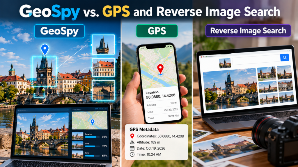
GeoSpy vs. GPS and Reverse Image Search
These approaches can complement one another, but they answer different questions.
| Method | Main Purpose | Key Limitation |
|---|---|---|
| GeoSpy-style AI geolocation | Estimate a location from visible image content. | Can produce incorrect or ambiguous predictions. |
| GPS metadata | Read coordinates recorded in a photo file. | Metadata may be absent, inaccurate, or altered. |
| Reverse image search | Find visually similar or matching images online. | May not find the original or establish the capture location. |
| Manual geolocation | Compare signs, landmarks, maps, and reference images. | Can require substantial time and local knowledge. |
GPS metadata can provide direct evidence about where a device recorded a photograph, but it does not necessarily establish where the image itself was originally taken. Metadata can be stripped, edited, or carried over incorrectly.
Reverse image search is useful when the same photograph, or a similar version, has already appeared online. AI geolocation is particularly relevant when there is no obvious matching image and the visible environment is the main source of evidence.
Combining these methods can be more reliable than relying on any single one.
Is GeoSpy Free? Pricing and Availability
Pricing depends on which service you mean by GeoSpy.
Graylark’s original GeoSpy platform transitioned to Raven in April 2026. Raven is available to qualified organizations, with access and purchasing arrangements handled through the company. Public product information directs interested organizations to request a demonstration rather than presenting a universal consumer subscription price.
Other services using the GeoSpy name may have different commercial models. For example, independently operated websites may offer web-based photo location estimation with different access arrangements from Graylark’s platform.
Before paying for any service, check:
- The exact website and operator.
- Whether the required features are available to individual users.
- Subscription renewal and cancellation terms.
- Image-processing and data-retention policies.
- Whether the service returns broad regions, street candidates, or precise coordinates.
- Whether API access is available if you need to process images programmatically.
Do not assume that a free tool, a mobile application, and an enterprise platform offer the same capabilities.
Privacy, Safety, and Ethical Considerations
AI image geolocation raises legitimate privacy concerns because a photograph can reveal information about a person’s surroundings even when GPS metadata is missing.
A picture shared publicly might expose a home entrance, workplace, school, or regular location. The risk is especially serious when images involve children, vulnerable individuals, or private residential spaces.
Responsible use includes the following precautions:
- Analyze photographs you own or have permission and a lawful reason to examine.
- Avoid trying to locate or track private individuals without authorization.
- Do not upload confidential photographs or personal documents to services without reviewing their privacy terms.
- Treat predictions as uncertain and corroborate important findings independently.
- Avoid publishing precise location information that could expose someone to harm.
- Follow applicable privacy laws and organizational policies.
It is equally important to distinguish between the capabilities of different providers. Their data-handling practices may differ, so read the privacy policy for the exact service you plan to use.
For professional investigations, access controls, audit trails, retention rules, and procedures for documenting uncertain findings should be part of the evaluation.
How to Evaluate an AI Photo Geolocation Tool
If you are considering GeoSpy or another image geolocation service, test it systematically rather than judging it by a few impressive demonstrations.
Step 1: Prepare a Representative Image Set
Use photographs with known capture locations, including different environments, image qualities, lighting conditions, and viewing angles.
Include both distinctive landmarks and ordinary streets. Testing only famous landmarks will give an incomplete picture of real-world performance.
Step 2: Define What Counts as Accurate
Decide whether your task requires the correct country, city, neighbourhood, street, or property. A result that identifies the right city may be useful for one task but inadequate for another.
Step 3: Compare Results Against Known Locations
Record whether the correct location appears among the predictions. For precise tasks, measure the geographical distance between the predicted and actual coordinates where those outputs are available.
Keep failed predictions in the evaluation rather than selecting only successful examples.
Step 4: Review Privacy and Operational Requirements
Determine how images are transmitted, processed, retained, and deleted. For API integrations, also check authentication, request limits, documentation, and the conditions governing commercial use.
Step 5: Require Human Review for Consequential Decisions
Do not use a predicted location as the sole basis for accusations, enforcement actions, or other high-impact decisions. An independent reviewer should examine the evidence and document any remaining uncertainty.
Frequently Asked Questions
What is GeoSpy used for?
GeoSpy was developed to estimate where photographs were taken using visual information. Its original technology now continues within Graylark’s broader Raven platform.
Is GeoSpy now called Raven?
Yes. Graylark transitioned GeoSpy to Raven in April 2026, expanding the platform beyond image geolocation into broader visual intelligence capabilities.
Can GeoSpy locate a photo without GPS?
Yes. Image geolocation can estimate a location from visible clues without relying on embedded GPS metadata. Accuracy varies by image and system.
Can GeoSpy identify an exact address?
Some professional workflows associated with Raven support street-level or property-level candidate locations in supported contexts. These are investigative leads requiring human verification, not guaranteed results.
Is GeoSpy safe to use?
Safety depends on the service, the image, and the purpose. Review the provider’s privacy policy, avoid sensitive uploads, and never use location estimates to stalk or harass people.
Is GeoSpy free?
There is no single price for every service using the name. Graylark’s Raven platform serves qualified organizations, while independent services may have separate free or paid plans.
Can GeoSpy make mistakes?
Yes. Similar-looking locations, poor image quality, limited visual context, and outdated surroundings can all lead to incorrect predictions. Important results need independent verification.
Conclusion
GeoSpy illustrates how AI can turn ordinary photographs into useful geographical clues. By analyzing architecture, infrastructure, landscapes, and other visible features, image geolocation systems can narrow down where a photograph may have been taken, even when GPS metadata is unavailable.
However, the technology is most useful when its predictions are treated as starting points for further investigation. A convincing result is not necessarily a correct one, and the level of precision needed depends on the task.
The other important consideration is product identity. Graylark’s original GeoSpy platform became Raven in April 2026, while independent websites and apps continue to use similar names. Anyone evaluating a tool should verify its operator, capabilities, pricing, and privacy practices before uploading images.
Used responsibly and checked against independent evidence, AI image geolocation can support research, journalism, photography, and authorized investigations without replacing human judgment.
[…] Codeium: Features, Benefits, Uses, and Alternatives GeoSpy: How AI Can Identify Where a Photo Was Taken How to Get Past Grok Moderation Safely Rundown AI: Is The Rundown AI Newsletter Worth It? […]